- Region
- Águilas
- Alhama de Murcia
- Jumilla
- Lorca
- Los Alcázares
- Mazarrón
- San Javier
-
ALL AREAS & TOWNS
- AREAS
- SOUTH WEST
- MAR MENOR
- MURCIA CITY & CENTRAL
- NORTH & NORTH WEST
- TOWNS
- Abanilla
- Abarán
- Aguilas
- Alamillo
- Alcantarilla
- Aledo
- Alhama de Murcia
- Archena
- Balsicas
- Blanca
- Bolnuevo
- Bullas
- Cañadas del Romero
- Cabo de Palos
- Calasparra
- Camping Bolnuevo
- Campo De Ricote
- Camposol
- Canada De La Lena
- Caravaca de la Cruz
- Cartagena
- Cehegin
- Ceuti
- Cieza
- Condado de Alhama
- Corvera
- Costa Cálida
- Cuevas De Almanzora
- Cuevas de Reyllo
- El Carmoli
- El Mojon
- El Molino (Puerto Lumbreras)
- El Pareton / Cantareros
- El Raso
- El Valle Golf Resort
- Fortuna
- Fuente Alamo
- Hacienda del Alamo Golf Resort
- Hacienda Riquelme Golf Resort
- Isla Plana
- Islas Menores & Mar de Cristal
- Jumilla
- La Azohia
- La Charca
- La Manga Club
- La Manga del Mar Menor
- La Pinilla
- La Puebla
- La Torre
- La Torre Golf Resort
- La Unión
- Las Palas
- Las Ramblas
- Las Ramblas Golf
- Las Torres de Cotillas
- Leiva
- Librilla
- Lo Pagan
- Lo Santiago
- Lorca
- Lorquí
- Los Alcázares
- Los Balcones
- Los Belones
- Los Canovas
- Los Nietos
- Los Perez (Tallante)
- Los Urrutias
- Los Ventorrillos
- Mar De Cristal
- Mar Menor
- Mar Menor Golf Resort
- Mazarrón
- Mazarrón Country Club
- Molina de Segura
- Moratalla
- Mula
- Murcia City
- Murcia Property
- Pareton
- Peraleja Golf Resort
- Perin
- Pilar de la Horadada
- Pinar de Campoverde
- Pinoso
- Playa Honda
- Playa Honda / Playa Paraíso
- Pliego
- Portmán
- Pozo Estrecho
- Puerto de Mazarrón
- Puerto Lumbreras
- Puntas De Calnegre
- Region of Murcia
- Ricote
- Roda Golf Resort
- Roldan
- Roldan and Lo Ferro
- San Javier
- San Pedro del Pinatar
- Santiago de la Ribera
- Sierra Espuña
- Sucina
- Tallante
- Terrazas de la Torre Golf Resort
- Torre Pacheco
- Totana
- What's On Weekly Bulletin
- Yecla


- EDITIONS:
 Spanish News Today
 Alicante Today
 Andalucia Today
article_detail
Date Published: 29/03/2012
Geology in Aledo
Aledo is a listed area of geological interest (LIG)
Aledo is an area which is of great interest to geologists due to the wealth of its fossil remains. The text below is fairly complicated for those with little interest in or knowledge of this subject, but for those in the know it illustrates the geological wealth of the area.
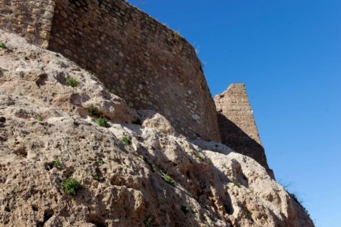
The staff at the tourist office are happy to help with directions about how to find any of the places mentioned here, all of which are very close to the centre of Aledo. From the castle, the council have devised the "Walk through time" route which leads down from the castle to the fossil remains.
The tourist office details are:
Tel: 696 962116
mail: turismo@aledo.es
Geologically speaking, Aledo is at the eastern end of the Neogene basin of Lorca, although it also contains Baetic material. The route described herein gives us the chance to follow some 20 million years of geological history.
20 million years ago, the Alpine orogeny (an orogeny is a severe structural deformation to the Earth's crust caused by the movement of tectonic plates) caused a fragment to travel hundreds of kilometers from the centre of the Mediterranean to the north-west, where it collided with the Iberian Peninsula (the Alborán plate).
This collision produced the mountains of the Region of Murcia, including the Sierra Espuña and another range which once occupied the area which is now the centre of the Guadalentín valley.
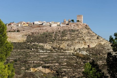 This cataclysmic collision also brought about important fault lines, including the North Baetic fault and the Alhama de Murcia fault, and these still cause earthquakes today. The mountain ranges were separated by lower areas which at that time were under the sea, and there was therefore an archipelago of islands between the Atlantic Ocean and the Mediterranean, in the area known as the North Baetic Straits.
The landscape we see in Aledo contains rocks which originated in one of these underwater areas, the Lorca basin. For geologists this area is an open book, each of its chapters consisting of the rocks found in the countryside.
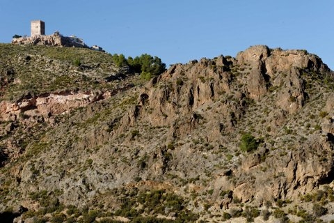
From the castle of Aledo it is possible to see nine rock formations which have been given names related to Aledo and Lorca: these names are used in order to explain the geology of the area and the route described later.
– Baetic (Paleozoic-Triassic): the oldest rocks can be seen on the eastern face of La Sierrecica. These are shiny blue rocks which were formed in relatively deep areas of the Earth’s crust by the effects of heightened pressure and temperature on clay. They are called phyllites, and were formed 290 million years ago in the centre of the Mediterranean. This is the substrate on top of which other rock formations lie.
– Carraclaca formation (Langhian-Serravalian): these intensely red rocks are fragments of stones of different compositions and sizes, and are below the viewing point at the castle in Aledo. They show that 16 million years ago the Lorca basin was gradually filled in by the sediment transported by water flowing from the ancient mountain range which no longer exists in the centre of what is now the valley of the Guadalentín river.
The ancient courses followed by these water flows can still be seen in the Rambla de Lébor.
– Manilla Formation (Lower Tortonian): the sandy limestones which formed the peak of Monte Villar, the whole of the northern slope of the Sierra de la Tercia and the middle of the hill on which Aledo stands show that about 11 million years ago the area sank, and was covered by the sea. The sandstone has numerous fossils in it, including sea urchins, and there are many of these to be seen in the Rambla de Lébor.
– Carivete Formation (Upper Tortonian): the yellowish earthy rocks which form the central depression of the landscape are called marl, and are formed by a mix of clay and limestone. They contain a large number of microscopic marine fossils which come from the plankton in the sea 9 million years ago. At that time the land suddenly rose, giving us the Sierra de la Tercia and the north of the Lorca basin, due to the clash of the African, Albórán and Iberian plates caused by the Alpine orogeny. The area between the plates was filled with marl deposits.
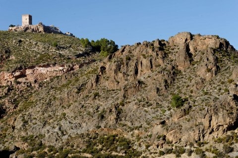 – Aledo formation (upper Tortonian): this consists of sandstone and is full of fossils, appearing in the higher regions of La Sierrecica, the Cabezo del Molino and the viewing point in Aledo itself. Interspersed in the rocks are various coral reefs. Geologists have deduced that as the Atlantic and the Mediterranean were gradually separated the sea level dropped, and there was a tropical climate in the area, with coral reefs along the coast.
– Nonihay formation (upper Tortoniense): these are detritus rocks brought by water gushing down from the Sierra Espuña to what was the shoreline 7 million years ago. From Aledo it is possible to see these rocks in the Cabezo del Molino, where magnificent examples of the delta formations are mixed with the sandstone of the Aledo formation, although unfortunately the spread of urban development has obscured some of them. The delta formations can also be seen towards the north-west, next to the road which leads from Aledo to Nonihay.
– Serrata formations (Messinian): about 6 million years ago the sea finally left Aledo and the whole of the Lorca basin. This retreat of the ocean was so significant that the whole of the Mediterranean dried up completely, leaving large deposits of salts (gypsum and halite) which can still be seen in many parts of Murcia. In the Lorca basin the salt deposits follow a ten-kilometre line starting in Aledo, near Los Allozos, and finishing near Lorca itself, forming the outcrop which is known as the Serrata formation. These rocks cannot be seen from the castle in Aledo.
– Torrealvilla formation (Messinian-Pliocene): following the departure of the sea, the area was still a depression, and it continued to be filled by the run-off from Sierra Espuña and the recently formed Sierra de la Tercia. This brought about a fluvial and aquatic environment, with small ponds and flood plains, where white and red clays and marls were deposited. Some of these can be seen towards the west, in the fields around the district of Nonihay.
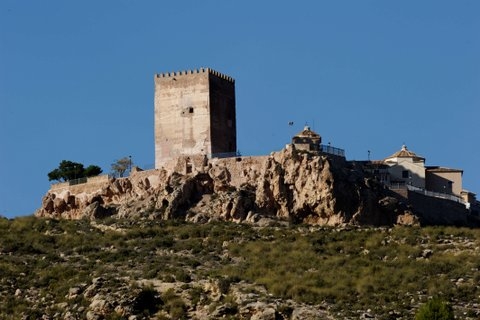 – Llano de las Cabras formation (Pleistocene): about two million years ago one of the best examples of glacis in the Region of Murcia was formed, with a thick limestone crust. This was the Llano de las Cabras, which was formed by the regular arrival of chemicals and detritus from the south-western slopes of Sierra Espuña. From Aledo it is possible to see the eastern end of this formation: to appreciate it fully it is best to climb the forest path on the northern slope of the Sierra de la Tercia.
– Mauta (Holocene): the sinking of the Guadalentín valley due to the movement of the Alhama de Murcia fault has left Aledo on raised ground, which has started to erode. The erosion is conditioned by the hardness of the rocks, the tectonics of the area, the climate, the connection between the Segura and Guadalentín rivers, the strength of the flow of water and human activity, and the current landscape has beautiful features such as the Mesa de La Sierrecica, the Cabezo del Molino, the ravines of the Rambla del Molino and the Rambla de Lébor, a narrow pass where all the forces of nature have combined to produce one of the most picturesque spots in the Region of Murcia.
Sedimentary deposits continue to form on the banks of these recently formed features and in the river beds, and there are fine examples of foothills, large fallen blocks of rock and fluvial terracing. The water has even deposited quicklime on the vegetation, leaving petrified plants which used to live in the area, and some of which still do. One of the best examples of these travertines is in the Cueva de la Mauta.
Contact Murcia Today: Editorial 000 000 000 /
Office 000 000 000


