- Region
- Águilas
- Alhama de Murcia
- Jumilla
- Lorca
- Los Alcázares
- Mazarrón
- San Javier
-
ALL AREAS & TOWNS
- AREAS
- SOUTH WEST
- MAR MENOR
- MURCIA CITY & CENTRAL
- NORTH & NORTH WEST
- TOWNS
- Abanilla
- Abarán
- Aguilas
- Alamillo
- Alcantarilla
- Aledo
- Alhama de Murcia
- Archena
- Balsicas
- Blanca
- Bolnuevo
- Bullas
- Cañadas del Romero
- Cabo de Palos
- Calasparra
- Camping Bolnuevo
- Campo De Ricote
- Camposol
- Canada De La Lena
- Caravaca de la Cruz
- Cartagena
- Cehegin
- Ceuti
- Cieza
- Condado de Alhama
- Corvera
- Costa Cálida
- Cuevas De Almanzora
- Cuevas de Reyllo
- El Carmoli
- El Mojon
- El Molino (Puerto Lumbreras)
- El Pareton / Cantareros
- El Raso
- El Valle Golf Resort
- Fortuna
- Fuente Alamo
- Hacienda del Alamo Golf Resort
- Hacienda Riquelme Golf Resort
- Isla Plana
- Islas Menores & Mar de Cristal
- Jumilla
- La Azohia
- La Charca
- La Manga Club
- La Manga del Mar Menor
- La Pinilla
- La Puebla
- La Torre
- La Torre Golf Resort
- La Unión
- Las Palas
- Las Ramblas
- Las Ramblas Golf
- Las Torres de Cotillas
- Leiva
- Librilla
- Lo Pagan
- Lo Santiago
- Lorca
- Lorquí
- Los Alcázares
- Los Balcones
- Los Belones
- Los Canovas
- Los Nietos
- Los Perez (Tallante)
- Los Urrutias
- Los Ventorrillos
- Mar De Cristal
- Mar Menor
- Mar Menor Golf Resort
- Mazarrón
- Mazarrón Country Club
- Molina de Segura
- Moratalla
- Mula
- Murcia City
- Murcia Property
- Pareton
- Peraleja Golf Resort
- Perin
- Pilar de la Horadada
- Pinar de Campoverde
- Pinoso
- Playa Honda
- Playa Honda / Playa Paraíso
- Pliego
- Portmán
- Pozo Estrecho
- Puerto de Mazarrón
- Puerto Lumbreras
- Puntas De Calnegre
- Region of Murcia
- Ricote
- Roda Golf Resort
- Roldan
- Roldan and Lo Ferro
- San Javier
- San Pedro del Pinatar
- Santiago de la Ribera
- Sierra Espuña
- Sucina
- Tallante
- Terrazas de la Torre Golf Resort
- Torre Pacheco
- Totana
- What's On Weekly Bulletin
- Yecla


- EDITIONS:
 Spanish News Today
 Alicante Today
 Andalucia Today
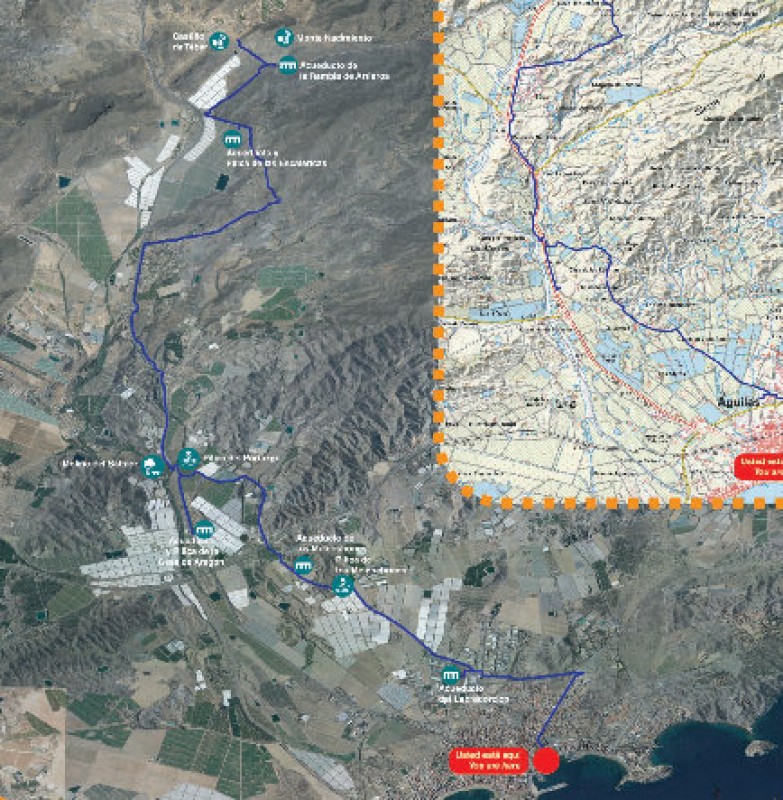
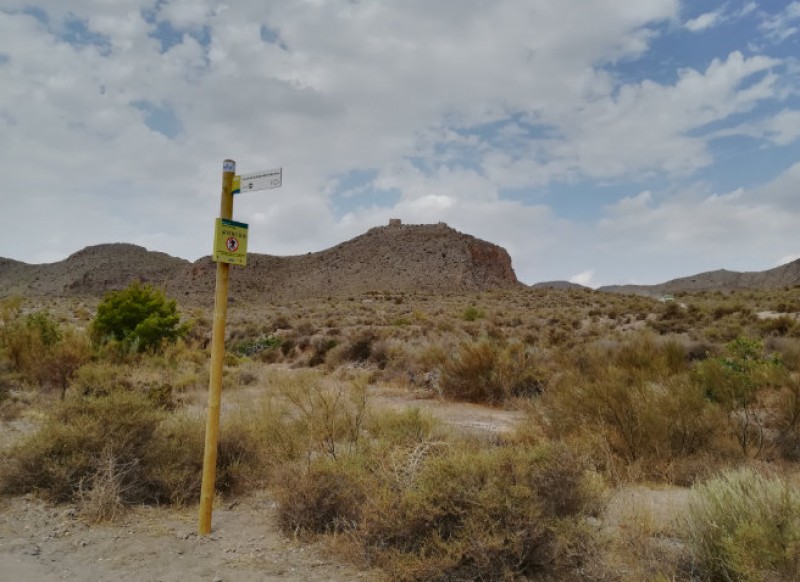
The Camino del Agua walking route in Águilas
The PR-MU 113 route is an 18-kilometre walk from the mountains behind Águilas to the town centre
This route is named after the old water supply channel from Tébar to Águilas, a canal which was built on the orders of King Carlos III in the 18th century with the aim of providing infrastructures for the growing town of Águilas.
It is a linear route of which all but 3 kilometres follows tarmacked road surfaces, and on either side are intensive farming concerns and greenhouses. While walking it is possible to see the structures of the old canal, although most are in a poor state of repair: some of the aqueducts and water deposits or “pilicas” along the way are the Acueducto de la Rambla de Arrieros, the Acueducto y Pilica de las Escalericas (which still carries water), the Acueducto y Pilica de Casa Aragón (which also still holds water) – all three of these are on the only diversion from the main route – and the Pilica del Portazgo.
The source of the water is a spring at the foot of Monte Nacimiento, and the water was channelled from this location. In order to cope with the uneven terrain a series of aqueducts of varying lengths and heights were built, and at various points along the canal drinking fountains and “pilicas” were created to supply water to the houses and cottages along the route, and to travellers on the road to Lorca. When it reached the town of Águilas, the water entered the Acueducto de Los Arcos, where there was a fountain, and skirted the hill known as Cabezo de los Alacranes before finally reaching the Plaza de los Caños.

This was the end of the canal, and in the square was the Fuente del Oro, the most iconic fountain and water source in the town, which was built in 1787 following the design of Juan de Villanueva, architect to the court of Carlos III. Originally the fountain featured four bronze taps with ornamental lion’s head designs – two more were added later – from where the water poured forth to supply the town. Any excess water was diverted via another canal to the wash-house which used to stand on what is now the crossroads of Avenida Juan Carlos I and Calle Doctor Luis Prieto, and the two canals still give their names to the streets of Cañería Alta (along which the supply to the fountain used to run) and Cañería Baja (the route to the wash-house).
Of course the route can be undertaken in the opposite direction, but it makes sense to follow the downhill journey of the water supply to Águilas in past centuries!
PR-MU 113
Length: 18 km (21 km including offshoots)
Ascent and descent: 18 metres and 491 metres (21 and 531 including offshoots)
Estimated duration: 5 hours (5 hours 40 including offshoots)
Start: Beneath the castle of Tébar
Finish: Plaza José García Cela
Click for the Wikiloc route map, or for more information about the municipality of Águilas visit Águilas Today.
staff.inc.ali


